|
|
|
|
|
|
|
1
|
|
2
|
3
|
4
|
5
|
6
|
7
|
8
|
|
9
|
10
|
11
|
12
|
13
|
14
|
15
|
|
16
|
17
|
18
|
19
|
20
|
21
|
22
|
|
23
|
24
|
25
|
26
|
27
|
28
|
29
|
|
30
|
|
|
|
|
|
|
|
|
38 registered members (BAR1225, Uokman2014, Grokamole, Chancetribe, Woody1, TexasHuntress, BradB, longshot, woodduck, desertdog, MarksOutdoors, CKyleC, Mossy, BC_Reb, Tree Dweller, G/H, RidgeRanger, paintrock, kodiak06, Mulcher, Claims Rep., deerkiller25, MountainTopHunter, brett.smith, Scout308, Okatuppa, GATA87, Stacey, Lonster, BCLC, William, DThrash, lpman, CNC, turkey247, 3 invisible),
487
guests, and 0
spiders. |
|
Key:
Admin,
Global Mod,
Mod
|
|
|
 Old Alabama Maps
#2120858
Old Alabama Maps
#2120858
05/23/17 07:52 AM
05/23/17 07:52 AM
|
Joined: Sep 2009
Posts: 6,378
somewhere around 112.
slippinlipjr
 OP
OP
I make Calds fer a livin
|
OP
I make Calds fer a livin
Joined: Sep 2009
Posts: 6,378
somewhere around 112.
|
When I was a kid I used to draw maps of land I hunted. I still have some of em. I was pretty darn good at it. I look back on them knowing I probably couldn't do that today if I tried. Here's one of the earliest English maps I have seen. Every now and then I look at old maps and wonder how people 300 years ago were able to draw such detailed and fairly accurate representations of their knowledge of the land. Note that back then, they often used "f" in place of "s". Cabo river is the Cahaba. They also marked good hunting land on this map. If y'all are interested in perusing old maps of Alabama, UA has a great website. Old Halbama Maps [img:left]http:// 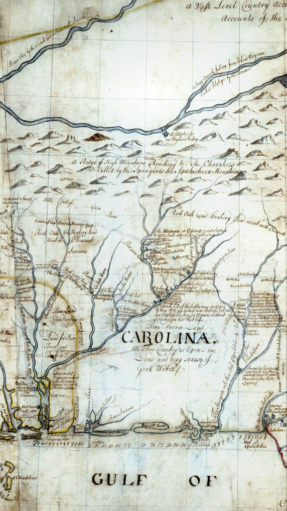 [/img] [img:left]http:// 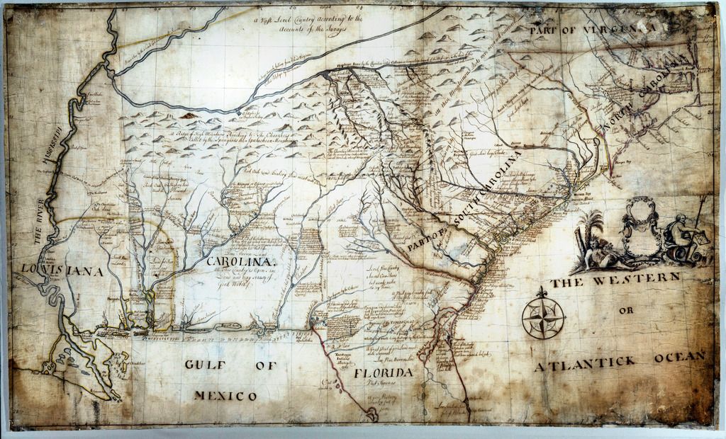 [/img]
|
|
|
|


